Vancouver Island is one of the most biodiverse areas in Canada. With a population of 900,000+ it’s the most populous island in Canada. Yes, Canada has many picturesque islands, which we reviewed in another article. This particular island is popular for many reasons.
When people and nature come together, we get some great opportunities for outstanding nature photos. We visited some of the most beautiful areas of the island and came up with the following list in no particular order.
- Saanich
- Lake Cowichan
- Crofton
- Nanaimo
- Tofino
- Sooke
Vancouver Island Photography Journey
The journey from Saanich to Tofino is a popular route through the island. The reason is simple, the government manages the ferry system and uses it to continue the highway that stretches across Canada onto Vancouver Island. The ferry from tsawwassen (mainland) to swartz bay (North Saanich) is one the most popular routes and it’s the start of our journey.
Tofino is an opportunity to see the west coast of Vancouver Island. It’s a popular tourist spot with long sandy beaches. So we end our article there. We also considered that many people visit Vancouver Island for a much shorter trip, so we are also including Sooke, since it’s also on the West Coast but requires far less time invested to get there when compared to Tofino.
Saanich
The District of Saanich is relatively large area compared to others on the island. Multiple provincial parks, 8.1749 square kilometres (3.1563 sq mi) of fresh water lakes, mountains, ferries, and even an airport. With over 110,000 people, this 103.44 square kilometres (39.94 sq mi) is a great place to take the perfect photo
Chances are that you are arriving here via ferry or plane, so take out your camera phone on approach. Once here, it’s time to pick your muse and plan your approach. With 29.61 kilometers (18.40 mi) of marine shoreline, you should plan your day vs guessing the best location if this is your photography focus.
Holder
Lake Cowichan
This beautiful area is surrounded by the sleepy towns of Youbou to the north and Harmony Bay to the south. This lake is one of the largest on the island and is surrounded by breathtaking elevation changes and landscapes
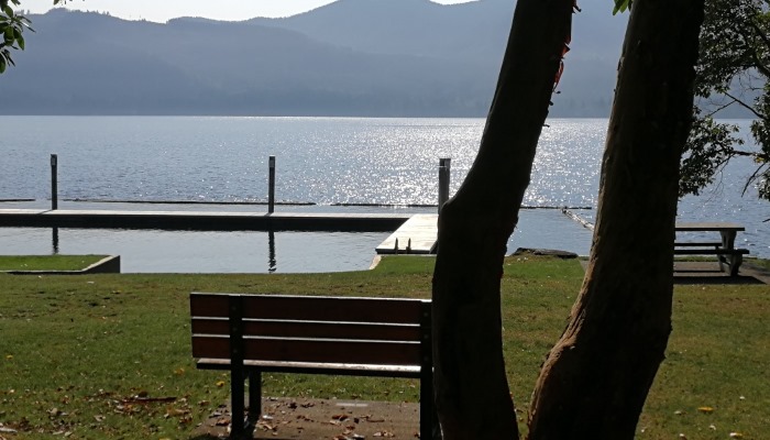
This tourist centre is popular for lake activity and logging. It’s in the middle of the island, about 50 mins drive from the nearest coast. This is a great place to set up your tripod and observe its beauty. Better yet, if you have a drone, view this area from the sky and be amazed.
Crofton
Vancouver Island is the largest of the gulf islands and it’s a great vantage point to take pictures of many of the nearby islands. In many cases, the only way to access some of the gulf islands is through Vancouver Island.
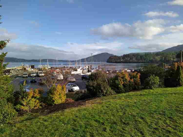
Salt Spring island is one of the largest gulf islands and is easily viewed from Crofton. On your way driving north up the coquihalla highway, once you pass Duncan, you will eventually have an opportunity to turn east towards Croton. There you will have a clear view of Salt Spring Island and one of the ferries that take you to the Vesuvius ferry terminal there.
Nanaimo
Technically, this is the most populous city on Vancouver Island with 90,000 people vs the provincial capital of Victoria with 85,000. 55 kilometers (34 mi) west of the most populated area in the province of Vancouver BC, Nanaimo is easy to access and shares similar weather
Much like the Saanich area, we found lots to keep our attention in this region. With a few smaller islands nearby, we particularly like the beach areas. However, Nanaimo is very diverse, offering lots of options for the keen photog.
It should be worth noting that along the entire east coast, there is an abandoned train line (E&N Railway) known as the island corridor that’s now used as a hiking path. This is a great opportunity for wildlife and nature photography across most of the east coast of Vancouver Island.
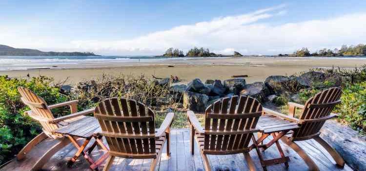
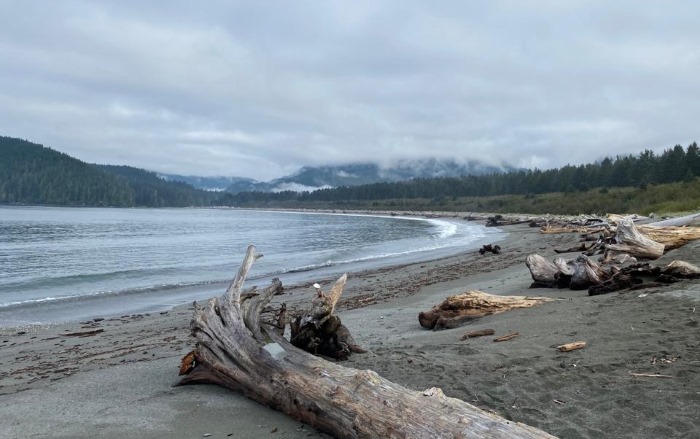
Tofino
So far, our journey has been on the east side of Vancouver Island. Once you get to Nanaimo, you have the opportunity to turn westward towards Tofino and Ucluelet.
Arguably the most famous tourist area on the island, this area is famous for its sandy beaches. What we remember most was that looking out into the ocean from Tofino, felt like the end of the world. You see, Tofino is on the west side of the island so there is nothing else until you hit Asia.
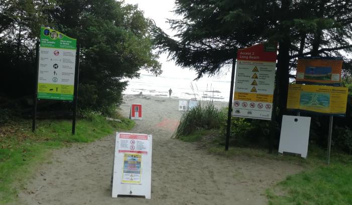
Again here the beaches are the attraction. However, there are lots of other activities to do in the area, like zip lining. It takes hours to drive here, through the mountainous backcountry. If you couldn’t find that perfect photo on the way in, rest assured you will find it while here.
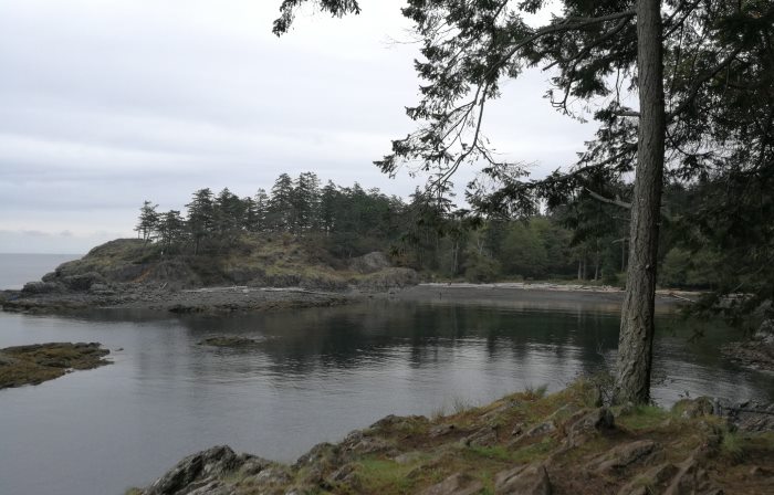
Sooke
Also on the west coast of Vancouver Island, this sleepy fishing village has one road in and out. It’s at the southwest of the island, making it a prime tsunami zone and a popular place for beaches. It’s relatively expensive to live here, and we see why. It’s a great place to live with hiking, kayaking, and lots of other outdoor activities. This is quintessential BC.
In this area we were particularly focused on the beach. Kayaking and camping in the area provides epic views of the surrounding topography.
Conclusion
If you like these photos, you can buy them and other Canadian photos in our store. We regularly review and upload photos from photographers across Canada.
We are always looking for the best places in Canada for outdoor photography. We live in the second-largest country on the planet. With a country this large, there is diversity, and beauty in that diversity.
If we missed your favorite locations on the island, comment below with your suggestions. We would be happy to add your favorites to this list.